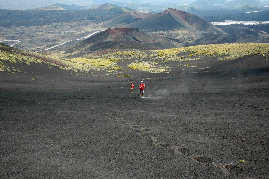
There is only one way to cross all the slopes of Etna far and wide: along the Altomontana track
The Altomontata slope is a ring truly within everyone's reach. It can be the starting point for more demanding excursions.
The ring of the Altomontana track can also be "broken up" into various parts
The route of the Altomontana track is 42 km long. The classic starting and ending points are the Pitarrone barracks located inside the Ragabo pine forest, on the north side, and the Milia wood on the south side.
Both are not reachable by public transport. And, to complete the circular route, a car should be parked in the "starting point" of the route and one in the arrival one.
Another flaw, not just, the lack of water. There are no natural springs at high altitude. The cisterns in the shelters provide non-potable rainwater, useful only for rinsing dishes and freshening the face.
Furthermore, many bivouacs could be closed upon your arrival or only partially open, since the Forestale does not open them all at the same time.
For a good Etna stay
At the stopping points of the Galvarina, Monte Scavo, Monte Maletto, Bosco La Nave and Saletti, there will almost always be a way to stay overnight, warming up with the wood present in the deposits adjacent to the tiny houses in lava stone.
The starry sky and the imposing coniferous woods will frame your short stay in Etna. It is very likely the encounter with various groups of hikers who weave their paths in one or the other direction.
La Altomontana slope it has a total height difference of about 300 meters
La Altomontana slope it has an average altitude of 1750 meters above sea level. And it is 42 km long in all.
Among the wild animals, it deserves a mention fox. Chances are you will find it in front of the door while you are roasting some sausages on the grill.
The ideal seasons to tackle this path are autumn and spring. In winter the snowfalls make the Altomontana slope even more fascinating. It can be tackled by putting on cross-country skis or snowshoes. However, it will be difficult to have a homogeneous coverage over the whole ring, due to the different exposures that make the snow cover uneven. And there is always the risk of having to travel stretches on foot.
In the summer months, the lack of water points is a significant obstacle. It will be necessary to further weigh down your backpack with stocks proportionate to the hydration needs.
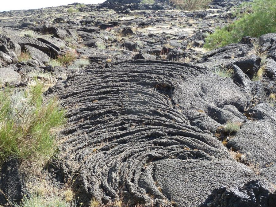
The Grotta del Gelo, the only glacier on the Volcano
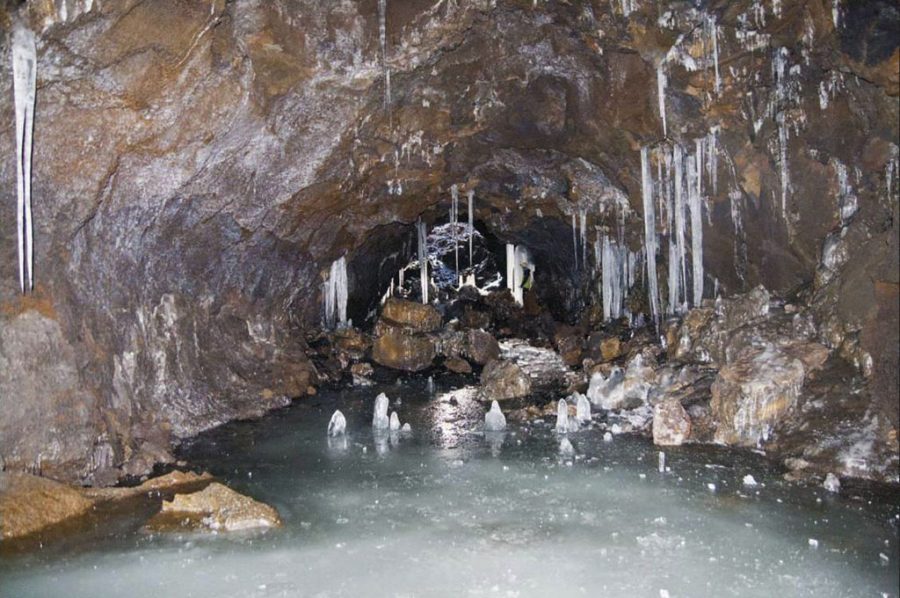
Anyone wishing to overdo it, once arrived on the north side can groped the "coup" with a visit to Cave of the Frost. The only glacier present on the volcano.
Compass and GPS are recommended. The possibility of getting lost in high altitude skiing due to a sudden fog is always lurking. Even if the path is well indicated on all maps and it is impossible to lose sight of the wide roadway on which even the Forestale jeeps pass, it is good to keep in mind that contacting a guide or a naturalistic association is the best alternative. to do it yourself.
The Italian Alpine Club of Catania, for example, inserts trips dedicated to the Altomontana slope into its programming every year. Including the ten-year “Etna ronda”, the tour of the refuges to be tackled in two or three consecutive days.